EuroGEOSS is the European component of the Global Earth Observation System of Systems (GEOSS) with a focus on coordinating and scaling up user-driven applications being developed in Europe. This GEO regional initiative aims to improve user uptake of Earth Observation data and improve forecasting capabilities for sound decision-making by governments for Europe’s benefit. The Group on Earth Observations (GEO) – a global effort to increase our understanding of Earth processes and improve forecasting. GEO is a partnership of more than 100 governments, 100 participating organisations and the European Commission. GEO implements GEOSS – decisions and actions for the benefit of humankind are informed by coordinated, comprehensive and sustained Earth observations. To get more details about EuroGEOSS visit the website and click here to download the infographic....
Tailoring Earth Observation Services to Europe’s needs – Coordinate, combine & cooperate
posted by EuroGeoSurveys
Insight for a Changing World: 14th Group on Earth Observation plenary
posted by EuroGeoSurveys
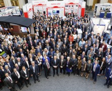
Last 23-27 October, the Group on Earth Observation (GEO) community came together at the Ronald Reagan Building in Washington, DC. to hold the 14th Group on Earth Observation plenary. About 700 people in attendance met to discuss the importance of making Earth observations data available and more readily accessible. “We are moving from a data-centric approach to a user-centric approach” highlighted GEO Secretariat director, Barbara Ryan, during the opening of the plenary. “It’s about closing the gap between users and providers”. GEO is a partnership of more than 100 national governments, 100 participating organizations and the European Commission. GEO implements the GEOSS, the global Earth observation system of systems. It envisions a future where decision and measures for the benefit of humankind are informed by coordinated, comprehensive and sustained Earth Observation. To implement this vision, GEO has divided the world into five regional areas. Europe is one of them and EuroGEOSS is the framework to combine the contributions of European GEO members. In order to support GEOSS, the EuroGeoSurveys Earth Observation and Geohazards Expert Group (EO EG) is leading one GEO Community Activity on Earth Observations for GeoHazards, land degradation and environmental monitoring included in the GEO Work Programme. The EO EG is also working on updating an European landslide inventory as well as creating an European landslide density map. This dataset is available to the public, scientific institutions and the broad spectrum of geoscience and risk management organisations. In addition, the group focuses on using Copernicus data for geological and anthropogenic hazard mapping such as landslide and subsidence dynamics, soil degradation and contamination. The EGS EO EG is currently working towards an implementation of future ground motion Copernicus services pushing the involvement of Geological Surveys in such processes. Underscoring the importance of Earth observations,...
The contribution of EuroGeoSurveys to the Group on Earth Observations
posted by EuroGeoSurveys
During the Thirteenth GEO Plenary Meeting, held in St Petersburg, Russian Federation, on 9-10 November 2016, representatives from the Group on Earth Observations (GEO) 103 Member governments and 106 Participating Organizations have assisted to launch of the new look of the Global Earth Observation System of Systems (GEOSS) Portal. At the event, the GEO Principal and Secretary General of EuroGeoSurveys, Mr. Demicheli, declared “Over the years, GEO has demonstrated a constant evolution, especially in the provision of free data sharing, creating value-added products and services for the benefit of society; and today, with the involvement of the commercial sector, is making another step forward“. In this framework EuroGeoSurveys contributes through several projects such as Minerals4EU, EMODnet-Geology, EGDI and GEOCRADLE. Minerals4EU is the most comprehensive source of minerals statistics for Europe. It presents, for the first time, official national level statistical data for 40 European countries, including all European Union (EU) Member States, countries in accession and potential candidates, as well as European Free Trade Association (EFTA) members. All the data is accessible digitally only, through the European Minerals Knowledge Data Platform. The Minerals Yearbook published last year contains a unique and invaluable series of in-situ data, which will be freely served to GEOSS. The sustainability of Minerals4EU is now guaranteed by the set up of the Minerals4EU Foundation that can be a major pillar to the success of the GEOSS Energy and Mineral Resources SBA. The GEOSS Energy and Mineral Resources SBA is supported also by a new project, FORAM, which will establish a World Forum on Raw Materials, bringing together all major global players in the field and where EuroGeoSurveys is one of the partners involved. Concerning the marine environment, EuroGeoSurveys runs the geological component of the European Marine Observation Data Network...
Earth Observation tools applied to the raw materials sector in Africa can really make a difference
posted by EuroGeoSurveys
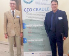
Earth Observation tools applied to the raw materials sector in Africa can really make a difference New opportunities of collaborations for increasing the capacity building in Africa The 2nd EuroGeoSurveys Networking workshop titled “Aimed at in-situ network operators and Geological Surveys – especially in Middle East and North Africa (MENA)”, held in Timimoun, Algeria, last 19th-22nd October 2016 was a great success. Over 200 participants representing the whole Algerian geoscientific community, mainly from universities and government institutions at the highest levels attended, included heads and managers of all the main Algerian state-enterprises. Also Tunisia was represented at Director General level. In Algeria several sectors are not fully open to the free market, and the state-enterprises manage most of the country’s resources, including raw materials. The GEO-CRADLE partners presented several aspects of the project via different presentations in plenary session, raising a big deal of attention. Mr. Luca Demicheli, Secretary General of EuroGeoSurveys, during its introduction highlighted “The potential for growth in Algeria is impressive, and in such wide territories rich in mineral resources, yet still largely unexplored, Earth Observation tools applied to the raw materials sector can really make a difference”. The role of Geological Surveys and the importance of the raw materials topics in the framework of GEOSS and COPERNICUS has been also pointed out. Mr. Marek Graniczny, representative of the Polish Geological Institute, and Chair of the International Cooperation and Development Task Force, described the specific role of EuroGeoSurveys and of raw materials for reaching the goals of GEO-CRADLE. The Deputy Chair of the EGS Earth Observation and GeoHazards Expert Group, Ms. Veronika Kopackova, entered into the technical details of the benefit of applying novel Earth Observation technologies to the raw materials sector. While the importance of capacity building and of...
GEO-XII Plenary & Ministerial Summit Week | The AfriGEOSS Side Event
posted by EuroGeoSurveys
The Group on Earth Observation XII Plenary and the 2015 Mexico City Ministerial Summit, as well as all associated meetings and events, will be hosted by the Government of Mexico and will take place in Mexico City from 9 to 13 November 2015. The AfriGEOSS Side Event will take place on the 10th of November 2015, (14.00 – 18.00 PM). The AfriGEOSS initiative, developed within the GEO framework, aims to enhance Africa’s capacity for producing, managing and using Earth observations data and information and to strengthen the link between GEO activities and existing capabilities and initiatives in Africa. The Side Event will review progress made towards the implementation of AfriGEOSS since its launch, including progress on developing the concept for data access and dissemination in Africa. The Workshop aims at creating synergies and coordination with a number of activities contributing to AfriGEOSS in order to strengthen efforts. In particular the side event will use the recently awarded PanAfGeo project to explore harmonization with existing efforts, especially in the area of mapping and training. PanAfGeo will enhance the capacity and role of African National Geological Surveys (i.e. regional mapping and exploration, mineral resources assessments, trainings, etc.), and therefore represents an opportunity for many African GEOSS stakeholders involved in the geosciences to have their concerns addressed. In this framework the session has the scope to initiate discussions on the involvement and role of non-Geological Survey stakeholders and the benefits to GEOSS. GEO has been formally listed as a key PanAfGeo stakeholder, and its opinion will be taken into consideration during the project development. Moreover PanAfGeo will partially continue the AEGOS (Africa-Europe Geoscientific Observation Network) Project, which was contributing to AfriGEOSS. If you are interested in attending the workshop, it is necessary to register at the following...
Copernicus Masters competition 2015
posted by EuroGeoSurveys
The Copernicus Masters competition 2015 is now open for submissions – with new challenges, industry leading partners and an immense prize pool. Since 2011, the Copernicus Masters competition (www.copernicus-masters.com) has awarded innovative products, services or applications that are based on Earth observation data. Its purpose is to drive the development of market-oriented applications for utilising data generated through Europe’s flagship satellite programme – Copernicus. In this year’s edition, prizes will be awarded in topic-specific challenges sponsored by a number of world-class partners, including: the European Space Agency (ESA), the German Aerospace Center (DLR), T-Systems International GmbH, Satellite Applications Catapult Ltd., Greece’s National Cadastre and Mapping Agency (NCMA), CloudEO AG, and European Space Imaging GmbH (EUSI). In addition, the new University Challenge specifically addresses students and research assistants around the world. The prize pool includes cash awards, satellite data access and quota as well as support-packages and is worth EUR 300,000. SMEs, start-ups, entrepreneurs, students and everyone with a brilliant idea is welcome to join and submit their entries from 15 April to 13 July 2015 at...

