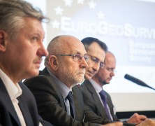
EuroGeoSurveys Membership –composed solely by the Geological Surveys of Europe – keeps growing steadily. At the EuroGeoSurveys General Meeting, held in Brussels on 24th March, EuroGeoSurveys welcomed 3 new members: the Latvian Environment, Geology and Meteorology Centre (LVGMC), the Geological Surveys of Serbia (GSS) and the Geological Survey of the Republic of Macedonia (GSRM). The vote, held in the morning during a closed-door session, brought the EGS Membership to 37 Geological Surveys, therefore almost fully covering the whole Europe. Ms. Anita Drondina, Head of Environment, Climate Change and Regional Policy Division at the Permanent Representation to the EU of Latvia, current President of the EU, and Ms. Inita Stikute, LVGMC Board Chair person, gave a presentation on the Latvian Environment, Geology and Meteorology Centre (LVGMC) and their interest in joining EGS as Full Member. The Geological Survey of Serbia (GSS) application as a Full Member was introduced by H.E. Ambassador Dusko Lopandic, Head of the Permanent Mission of the Republic of Serbia to the European Union, while Mr. Dragoman Rabrenovic, Director of GSS, presented the organization. H.E. Ambassador Andrej Lepavcov, Head of the Mission of the Republic of Macedonia to the European Union, introduced the application of the Geological Survey of Macedonia (GSRM). After the presentation of the Survey given by the Director Mr. Kostadin Jovanov, GSRM was officially introduced as Full Member of EGS. Moreover, in the afternoon session EuroGeoSurveys and the Geological Survey of Turkey (MTA) signed a Memorandum of Understanding. The agreement was signed by EGS President Mr. Koen Verbruggen and the MTA Director General Mr. Yusuf Ziya Cosar and is aimed to exchange scientific and technical experience and knowledge in areas such as marine geology, waste characterisation, climate change, preparation of geochemical atlas, etc. The enlargement of the EGS Membership,...
EuroGeoSurveys Membership keeps growing – towards a pan-European Geological service
posted by EuroGeoSurveys
UNDERGROUND CHANNEL, the first geoscience video channel
posted by EuroGeoSurveys
Geocenter Danmark launches online video channel focusing on the geosciences. UNDERGROUND CHANNEL. Today sees the launch of the world’s first online video channel focusing on the geosciences. Backed by some of Denmark’s most prestigious research institutions, UNDERGROUND CHANNEL will use film to address the complicated challenges facing the planet – climate change, resource utilisation and sourcing clean drinking water – and to examine extreme phenomena such as earthquakes, volcanoes and tsunamis. “We live in an era of ever-increasing focus on the pursuit and distribution of the Earth’s resources. Competition for water, minerals and oil, the fear of climate change and concerns about the planet’s overall well-being have brought geology and the geosciences much closer to our everyday lives,” says Professor Kurt Kjær, a member of Geocenter Denmark’s management group and acting director of the Natural History Museum of Denmark. “But it’s sometimes difficult for school students and laypeople to find out about the state of the planet, its powerful natural forces and scarce resources, and about our collective future. That’s why we are launching UNDERGROUND CHANNEL – the world’s first online video channel focusing on the geosciences.” A window to the past – and the future “The Earth’s past seems infinite. It’s hard to imagine oceans emerging or continents moving. We’ll never be able to experience these processes in real time. But, by utilising the latest research, UNDERGROUND CHANNEL will create a window through which everyone can catch a glimpse both of our planet’s history and of what the future might hold,” says Anders Drud Jordan, project manager for UNDERGROUND CHANNEL. UNDERGROUND CHANNEL is backed by Geocenter Denmark – a formal collaboration between four of Denmark’s strongest geoscience institutions, all of which bring their expertise and latest research findings to the project. The institutions...
Global Soil Week 2015
posted by EuroGeoSurveys
The Global Soil Week 2015, a multi-stakeholder platform and process for the transformative change towards a more sustainable soil management and a more responsible land governance in our world, will take place from 19th to 23rd April 2015. This year’s Global Soil Week will highlight the importance of land and soil to achieve the Sustainable Development Goals in this, the UN designated International Year of Soils. On Thursday 23rd April Rainer Baritz, Chair of the EuroGeoSurveys Soil Resources and Superficial Deposit Task Force, will participate in the Open-Space Session “Discussion on European soil data base update in light of the revision of the Soil Atlas of Europe: examples from Finland and Central European countries” with the presentation “Parent material data for soil mapping and soil engineering in Europe”. The session is hosted by the European Commission Directorate General Joint Research Centre (DG JRC). The discussions aim to update information in the European Soil Database of mainly Central European countries. A specific example of the Finnish field-work approach to up updating information on agricultural soils will be presented as well. This update will contribute to the second edition of the Soil Atlas of Europe. This session is also open to institutions or researchers from other parts of Europe that are planning on updating their data in the European database. The work on the second Soil Atlas of Europe has started and this session will contribute towards updating maps for the new Atlas. The EGS contribution is part of the cooperation agreement with the DG JRC and the Global Soil Partnership (GSP) – supporting soil scientists with geoscientific knowledge and data and enhancing available information on soil for policy makers, researchers and society at large. For more information click here http://globalsoilweek.org/ ...
Copernicus Masters competition 2015
posted by EuroGeoSurveys
The Copernicus Masters competition 2015 is now open for submissions – with new challenges, industry leading partners and an immense prize pool. Since 2011, the Copernicus Masters competition (www.copernicus-masters.com) has awarded innovative products, services or applications that are based on Earth observation data. Its purpose is to drive the development of market-oriented applications for utilising data generated through Europe’s flagship satellite programme – Copernicus. In this year’s edition, prizes will be awarded in topic-specific challenges sponsored by a number of world-class partners, including: the European Space Agency (ESA), the German Aerospace Center (DLR), T-Systems International GmbH, Satellite Applications Catapult Ltd., Greece’s National Cadastre and Mapping Agency (NCMA), CloudEO AG, and European Space Imaging GmbH (EUSI). In addition, the new University Challenge specifically addresses students and research assistants around the world. The prize pool includes cash awards, satellite data access and quota as well as support-packages and is worth EUR 300,000. SMEs, start-ups, entrepreneurs, students and everyone with a brilliant idea is welcome to join and submit their entries from 15 April to 13 July 2015 at...
EU-wide survey on 3D modelling activities at Geological Survey Organisation
posted by EuroGeoSurveys
Online poll among European Geological Survey Organisations summarises activities in the field of 3D geological modelling and reveals the current state of progress An online survey was carried out across federal and state geological surveys of Europe between December 2014 and February 2015 to reveal the current state of progress in 3D geological modelling as well as the financial and human resources involved in geological modelling activities. Thirty-six institutions responded to the questionnaire leading to an almost complete coverage of European countries. Results show that 3D geological modelling at geological surveys really took off between 2001 and 2010 and by now, more than half of the participating countries have covered at least 20% of their area with regional scale geological models. In 2014, most survey organisations spent up to 50,000€ on 3D modelling. On average 60% of the total modelling budget are spent on modelling per se, while 10% go to software licence fees, 10% to programming and 20% to model dissemination. Virtually all Geological Survey Organisations in Europe perform 3D geological modelling as part of research projects related to groundwater, mineral resources or geothermal energy. As to the systematic 3D mapping of the subsurface, ten countries / states in Europe stipulate 3D geological models by legal mandate. Only in four of those, there also are legal requirements to follow national standards for 3D data models. While most geological surveys carry out geological modelling by employing their own staff, some have outsourced the task to research institutes and/or universities. Although some modelling activities were undertaken already in the eighties and nineties, the majority of geological survey organisations started 3D geological modelling between 2001 and 2010. Up until now they spent up to ten person-years on modelling. By the end of 2014,...