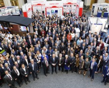
Last 23-27 October, the Group on Earth Observation (GEO) community came together at the Ronald Reagan Building in Washington, DC. to hold the 14th Group on Earth Observation plenary. About 700 people in attendance met to discuss the importance of making Earth observations data available and more readily accessible. “We are moving from a data-centric approach to a user-centric approach” highlighted GEO Secretariat director, Barbara Ryan, during the opening of the plenary. “It’s about closing the gap between users and providers”. GEO is a partnership of more than 100 national governments, 100 participating organizations and the European Commission. GEO implements the GEOSS, the global Earth observation system of systems. It envisions a future where decision and measures for the benefit of humankind are informed by coordinated, comprehensive and sustained Earth Observation. To implement this vision, GEO has divided the world into five regional areas. Europe is one of them and EuroGEOSS is the framework to combine the contributions of European GEO members. In order to support GEOSS, the EuroGeoSurveys Earth Observation and Geohazards Expert Group (EO EG) is leading one GEO Community Activity on Earth Observations for GeoHazards, land degradation and environmental monitoring included in the GEO Work Programme. The EO EG is also working on updating an European landslide inventory as well as creating an European landslide density map. This dataset is available to the public, scientific institutions and the broad spectrum of geoscience and risk management organisations. In addition, the group focuses on using Copernicus data for geological and anthropogenic hazard mapping such as landslide and subsidence dynamics, soil degradation and contamination. The EGS EO EG is currently working towards an implementation of future ground motion Copernicus services pushing the involvement of Geological Surveys in such processes. Underscoring the importance of Earth observations,...
Establishing the European Geological Surveys Research Area to deliver a Geological Service for Europe (GeoERA)
posted by admin
Today, more than 40 national and regional Geological Survey Organisations (GSOs) from over 30 European countries have joined forces to launch the ERA‐NET co-fund action “Establishing the European Geological Surveys Research Area to deliver a Geological Service for Europe (GeoERA)”. The integration of the participants’ knowledge and information on subsurface resources, to support sustainable use of the subsurface and to address some of Europe’s grand challenges, is the key aim of GeoERA. The GeoERA programme, was initiated through EuroGeoSurveys – the organisation of European Geological Surveys, as part of the realization of its “vision towards a Geological Service for Europe” and extended to all GSOs on the European continent. It has an overall budget of 30.3 M€, of which 10 M€ is provided by European Commission and the remainder is provided by the GeoERA participants as in‐kind contributions to the funded transnational projects. It will provide interoperable, pan‐European data and information services on the distribution of geo‐energy, groundwater and raw material resources and harmonized methods to assess these. It will also develop common assessment frameworks and methodologies for supporting the European national and regional policy-makers for a better understanding and management of the water‐energy‐raw materials nexus to determine potential impacts and risks of subsurface use. Mrs Teresa Ponce de Leão, EuroGeoSurveys President, says “GeoERA represents the key step for establishing a common European Knowledge Base and to a joint provision of a Geological Service for Europe. The Geological Knowledge Base will provide European stakeholders with open access to objective and seamless data, information, knowledge and expertise on subsurface resources and their sustainable use and management”. Mrs Yvonne Schavemaker, GeoERA Project Manager, highlights the large impact GeoERA will have in integrating and harmonizing national and regional research resources and optimizing pan‐European coverage of geological...
EuroGeoSurveys at INSPIRE Conference 2016
posted by EuroGeoSurveys
The major event INSPIRE Conference was held in Barcelona on the 26th-30th September 2016. Introduced by Mr de Groof (European Commission DG for Environment), EuroGeoSurveys Secretary General Mr Luca Demicheli gave a remarkable talk on the European Geological Surveys contribution to INSPIRE, from One-Geology Europe to EGDI. “EGDI now is a reality in a new portal, where there is already a prototype perfectly functioning” “You can have access through a very simple system to information provided by the National Geological Surveys, all harmonized, INSPIRE-compliant, etc. It’s a fantastic tool” “We can state that now for the first time there is a home for pan-european geological datasets and services from past and ongoing projects. That will stay there forever, as we will maintain it” The INSPIRE Directive aims to create a European Union spatial data infrastructure for the purposes of EU environmental policies and policies or activities which may have an impact on the environment....


