Brussels, 04 March 2016 Following the huge success of the European Intelligence Network on the Supply of Raw Materials (Minerals4EU) project, the “Minerals Intelligence Infrastructure for Europe” has been legally registered under the form of a Foundation on Friday 4th March 2016. The non-profit Minerals4EU Foundation overall scope is to provide a one-stop-shop to official and verified data, information and knowledge on mineral resources, and to act as contact point through which stakeholders can easily and transparently access its products and expertise. Among its main services, the Foundation will coordinate the development of the European Union Mineral Resources Knowledge Base infrastructure, in support to European Union affairs, policies and action programmes, and will provide the best available EU expertise and information based on the knowledge of its Members, composing the European Minerals Intelligence Network. Moreover, the Minerals4EU Foundation will respond to specific requests from the European Union, or will formulate proposals for actions of interest to the EU. The Foundation is governed by a Management Board overseeing the whole management of the organization and composed of both private and public sector key EU stakeholders representing the whole mineral resources value chain. It is expected that the services put in place will ultimately serve to boost EU economy and competitiveness in the field of Raw Materials. BACKGROUND The Minerals4EU project delivered a European Minerals Knowledge Data Platform (EU-MKDP). The Platform contains a Mineral Resources Database, Map Viewer, Foresight studies and the European Minerals Yearbook, first digital reliable source of information on minerals statistics and intelligence in Europe. More information at http://www.minerals4eu.eu EuroGeoSurveys – web: http://www.eurogeosurveys.org/ Email: claudia.delfini@eurogeosurveys.org francesca.siciliano@eurogeosurveys.org Phone: +32 2 888 75...
The Minerals4EU Foundation, the new private-public bridge for the EU Raw Materials sector
posted by EuroGeoSurveys
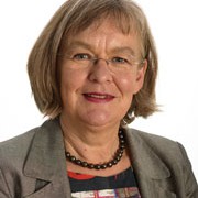
The nuclear waste management in Sweden – Interview with Ms Lena Söderberg, Director General of SGU
posted by EuroGeoSurveys
Following up Finland recent pioneering project for building a deep storage of nuclear waste, how is Sweden current position on this topic and which are the implications for SGU? Responsibility in Sweden for taking care of the nuclear waste from the Swedish nuclear plants lies with the Swedish Nuclear Fuel and Waste Management Co (SKB). Site investigations have been carried out at two different locations along the South-East coast of Sweden, at Forsmark, c. 120 km North of Stockholm, and at Oskarshamn, c. 230 km South of Stockholm, with the objective of siting an underground repository for spent nuclear fuel. The current position in Sweden is that on the 16th of March 2011 SKB submitted a licence application to the Swedish Radiation Safety Authority (SSM) for the construction of a spent nuclear fuel repository at Forsmark and an encapsulation plant at Oskarshamn. The regulatory review of SKB’s licence application is ongoing, and the formal findings are planned to be submitted by SSM to the Swedish Government in 2017. The Swedish government takes the ultimate decision on whether or not to allow these final disposal facilities to be constructed, but not before the municipalities concerned have given their approval. A review is also undertaken by the Land and Environment Court based on the Environmental Code. Expertise at SGU has been involved in the geological investigations of both sites and also the site descriptive geological modelling work, primarily concerning bedrock geology and unconsolidated deposits. The site descriptive modelling also included the geological, palaeoclimate and historical evolution, as well as future development of the landscape at both sites. However, it should be noted that geological expertise at SGU has not been involved in SKB´s site selection process, but only in the development of an understanding of the...
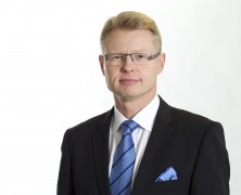
The nuclear waste repository in Finland – Interview with Mr Mika Nykänen, Director General of GTK
posted by EuroGeoSurveys
Finland recently approved the construction of a nuclear waste repository within its territory, after more than 30 years of investigations. The construction license was granted on 12 November 2015. Construction work can be started at Olkiluoto at the end of 2016. The disposal facility is expected to be ready for operation in 2023. Why is Finland the first country in the world to start operating a spent nuclear fuel disposal facility? First of all, we are fortunate to have ancient crystalline bedrock suitable for geological waste disposal. Seismic activity is low, there is no volcanic activity and the bedrock properties related, for example, to groundwater flow are favourable. In the past, GTK has carried out nationwide geological, geochemical and geophysical mapping, so the records provided a good starting point for evaluating the suitability of the bedrock and for site selection investigations. It was easy to find numerous candidate sites meeting the requirements of international standards. Nevertheless, a lot of complementary studies specific for nuclear waste disposal were required, and that’s what we have been doing during the past decades. Another key element is long-term planning. After the Finnish bedrock was shown to be suitable for nuclear waste disposal, the Finnish Government already made a decision-in-principle in 1983, which defined the objectives and schedule for nuclear waste management. Thus, together with the Nuclear Energy Act, the responsibilities of the various parties (industry, regulators, government) were clearly defined. The funding of the Nuclear Waste Management Fund was also organized. Without political acceptance and general transparency, nuclear waste programmes cannot proceed. Now that the construction license has been granted, will GTK maintain its research activities linked to the spent nuclear fuel disposal facility at Olkiluoto? Definitely, yes. Nuclear waste disposal is moving from site characterization to the...
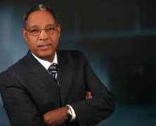
Supporting Earth Sciences development in Africa: Interview with Mr Mogessie, Fellow of the African Academy of Sciences
posted by EuroGeoSurveys
Mr Mogessie, you have recently been elected Fellow of the African Academy of Sciences, representing one of the highest excellences of the continent in the Earth Sciences. In light of this prestigious role, how would you envisage the development of Earth Sciences disciplines in Africa? Yes, I am elected Fellow of the African Academy of Sciences (AAS) recently, and since May 2015, I had the honor to be elected Fellow of the Geological Society of America (GSA), receive a Certificate of Recognition from the Society of Economic Geologists (SEG) for 25 years of distinguished service, and also elected as Associate Fellow of the Ethiopian Academy of Sciences (EAS). This is a great honor for me and a recognition of my service to the earth sciences development in research and education in Africa, which I have been promoting as elected President of the Geological Society of Africa since 2008. In light of my role, I envisage the development of Earth Sciences disciplines in Africa as encouraging. As you may know Africa is a big continent with an area of over 30 million Km2 and a population of ca. 1.1 Billion at the moment, increasing at an alarming rate and expected to reach 3 billion by the year 2100. We should therefore see the development of the Earth Sciences and other sectors from this perspective. During the last decade Africa has made progress in many fields among which there is the Earth Sciences. The coming August and early September 2016, we will organize the 35th International Geological Congress at the Cape Town Convention Center, where we expect more than 5000 earth scientists from all over the world to gather and discuss about their research results in the different fields of Earth Sciences. Among the topics of...
RAW MATERIALS INTELLIGENCE TO SERVE STAKEHOLDERS NEEDS
posted by EuroGeoSurveys
PRESS RELEASE RAW MATERIALS INTELLIGENCE TO SERVE STAKEHOLDERS NEEDS 4 February Primary and secondary Raw Materials are essential to Europe’s economy and growth. The Minerals Intelligence Capacity Analysis (MICA) Project responds to the need to build a Raw Materials Knowledge Base at EU level, contributing to past and ongoing efforts by several EU projects and as part of the transitional phase towards this goal. The MICA Partners gathered together for the first time at the Project kick-off meeting held in Copenhagen on the 2-4 February 2016. The overall objective of MICA is to provide stakeholders with the best possible information, in a seamless and flexible way using a Web-based platform, the European Union Raw Materials Intelligence Capacity Platform (EU-RMICP). To reach this ambitious goal, MICA brings together a multidisciplinary team of experts, from natural and technical to social sciences, to ensure that the raw materials intelligence is collected, stored and made accessible according to stakeholders needs. The kick-off meeting, which included Technical Workshops, aimed at presenting all the Work Packages under which the activities will be carried and it introduced all the partners involved. The EU representatives presented the relevant policy frameworks and their expectations from the project. In particular, Mr Slavko Solar from the European Commission DG GROW, said that it is expected that MICA will contribute to shape the EU policy on Raw Materials and will foster the cooperation among past, current and future projects tackling the same issues. The cooperation with the industry, the KIC Raw Materials and the United States Geological Survey (USGS) is also considered as essential during the project lifetime. Indeed, representatives of those parties are part of the Advisory Board of the MICA Project. Background The MICA Project is coordinated by the Geological Survey of Denmark and...
The role of CCS (Carbon dioxide Capture and Storage) in mitigating climate change
posted by EuroGeoSurveys
The ambition of the European Union is to deliver a secure, competitive and sustainable energy system, while reducing GHG emissions by at least 40% by 2030 on 1990 levels. The European Strategic Energy Plan (SET plan) aims to accelerate the development and deployment of low carbon technologies and recognizes CCS as an important mitigation technology. The wide-scale deployment and transfer of carbon dioxide capture, transport and storage (CCS) is recognized by the UNFCCC as an environmentally sound technology; as well as by the International Energy Agency (IEA) as a major opportunity for cost–effectively reducing global emissions. For large-scale emissions to be managed adequately within the time frames required, CCS must be allowed to play its crucial role in the decarbonisation of the energy and industrial sectors. CO2GeoNet – The European Network of Excellence on the Geological Storage of CO2, joins together 26 partners from 19 European countries, ranging from national geological surveys, through to research institutes and universities, all with a high international profile and critical mass in CO2 geological storage research. CO2GeoNet is contributing, in collaboration with other international organisations, to side-events and booths at COP21. EuroGeoSurveys is co-organizer together with the European Energy Research Alliance and the Global CCS Institute of the side event “The role of CCS in mitigating climate change” that will be held at the EU Pavillon, room Luxembourg at 10:15-11:00 o’clock. Key players from research organisations, major CCS knowledge networks and initiatives as well as key policy makers in Europe will discuss with the audience the status and way forward for CCS as part of Europe’s low carbon future. The role of CCS in mitigating climate change 10:15-11:00 (EU Pavillon, room...
Interview with Mr Kostadin Jovanov, Director of the Geological Survey of Macedonia
posted by EuroGeoSurveys
Could you describe the main activities of the Geological Survey of Macedonia and its public role in FYROM? The Geological Survey of the Republic of Macedonia is an expert, independent, administrative organization, established for doing basic geological research of public interest in the Republic of Macedonia. Most of our activities are focused mainly on the development of geological research related in particular to the preparation of basic geological, hydrogeological, engineering-geology, geochemical and seismotectonic maps and other geological maps, making them available to the public . All the work that we carry out is done on the basis of – and following the – priorities of the Republic of Macedonia We are very active also in the determination of the legal regularity of concentration and distribution of natural mineral resources in the Earth’s crust. In particular, we take part in the preparation of the Strategy for geological research, use and sustainable exploitation of minerals. Moreover our geological knowledge is essential for physical planning, construction, water supply, agriculture, forestry, urbanization and construction of infrastructure facilities, helping policy makers to make the best choices for the development of our country. We really believe in the exchange of geological information and experiences with international geological institutions in order to prepare and develop common research projects and to unify synergies for the implementation of the International Geological Information System, a single Geological Information System, able to provide information and data to the users of geological research results. We are also developing a Programme for basic geological research of the area of the Republic of Macedonia for the Government of the Republic of Macedonia The basic geological research is developed through an Annual Programme, which is adopted by the Government of the Republic of Macedonia upon advice of the Geological...
Interview with Ms Daiga Pipira, Head of Geology Division at the Latvian Environment, Geology and Meteorology Centre
posted by EuroGeoSurveys
What is the basic role of the Latvian Environment, Geology and Meteorology Centre in Latvia? What are the main research areas? State Ltd. “Latvian Environment, Geology and Meteorology Center” (LEGMC) is the largest institution in Latvia engaged in the collection and processing of geological information. However, the main areas of research at LEGMC also include meteorological and hydrological observations and forecasting, air quality monitoring, chemicals and hazardous waste management. For this work LEGMC employs 260 lead qualification specialists. LEGMC Information Analysis Department has several branches: Division of Geology, Division of Inland Waters (hydrology and hydrogeology), Chemicals and Hazardous Waste, and Air and Climate Division. The main activities in the field of geology can be divided into three basic groups: 1) accomplishment of State delegated assignments, 2) commercial side which includes preparation of geological information upon request of other institutions and private sector and 3) participating into national and international projects of different scale. The main tasks of LEGMC in the area of geology are following: Approval of mineral reserves according to the legislation; Preparation of the annual balance of mineral reserves, collection and storage of geological information; Preparation and provision of geological and geospatial information for the needs of the state, society and land users; Investigations of quality of subsoil, geological and geoecological investigations of different hazards to the environment and population; Preparation and evaluation of information regarding mineral deposits occurring in subsoil; Seismic monitoring. Collection and storage of geological information is the main task of LEGMC according to Law on Subsoil. Almost 30,000 thousand reports as well as maps and field books are stored in the State Geological Fund: results of geological mapping, results of geological prospecting, information on mineral deposits and mineral resources, results of geology investigations and engineering, geoecological investigations. This...
EGG: European Groundwater Geochemistry, a model geochemical study of bottled mineral water in Europe
posted by EuroGeoSurveys
A paper on European Groundwater Geochemistry has just been published in the “European Geologist”, the Journal of the European Federation of Geologists, special issue “Towards 2020: groundwater research in Europe”. Demetriades, A., Cullen, K., Reimann, C. & Birke, M., 2015. EGG: European Groundwater Geochemistry. Special Issue: Towards 2020: groundwater research in Europe, European Geologist, 40, 20-28. To download the paper, click here The full version of the Special Issue can be downloaded at http://eurogeologists.eu/wp-content/uploads/2015/11/EGJ40_final_LR.pdf...
GEO-XII Plenary & Ministerial Summit Week | The AfriGEOSS Side Event
posted by EuroGeoSurveys
The Group on Earth Observation XII Plenary and the 2015 Mexico City Ministerial Summit, as well as all associated meetings and events, will be hosted by the Government of Mexico and will take place in Mexico City from 9 to 13 November 2015. The AfriGEOSS Side Event will take place on the 10th of November 2015, (14.00 – 18.00 PM). The AfriGEOSS initiative, developed within the GEO framework, aims to enhance Africa’s capacity for producing, managing and using Earth observations data and information and to strengthen the link between GEO activities and existing capabilities and initiatives in Africa. The Side Event will review progress made towards the implementation of AfriGEOSS since its launch, including progress on developing the concept for data access and dissemination in Africa. The Workshop aims at creating synergies and coordination with a number of activities contributing to AfriGEOSS in order to strengthen efforts. In particular the side event will use the recently awarded PanAfGeo project to explore harmonization with existing efforts, especially in the area of mapping and training. PanAfGeo will enhance the capacity and role of African National Geological Surveys (i.e. regional mapping and exploration, mineral resources assessments, trainings, etc.), and therefore represents an opportunity for many African GEOSS stakeholders involved in the geosciences to have their concerns addressed. In this framework the session has the scope to initiate discussions on the involvement and role of non-Geological Survey stakeholders and the benefits to GEOSS. GEO has been formally listed as a key PanAfGeo stakeholder, and its opinion will be taken into consideration during the project development. Moreover PanAfGeo will partially continue the AEGOS (Africa-Europe Geoscientific Observation Network) Project, which was contributing to AfriGEOSS. If you are interested in attending the workshop, it is necessary to register at the following...

