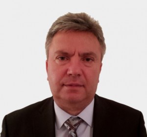
Interview with Mr Kostadin Jovanov, Director of the Geological Survey of Macedonia
- Could you describe the main activities of the Geological Survey of Macedonia and its public role in FYROM?
 The Geological Survey of the Republic of Macedonia is an expert, independent, administrative organization, established for doing basic geological research of public interest in the Republic of Macedonia.
Most of our activities are focused mainly on the development of geological research related in particular to the preparation of basic geological, hydrogeological, engineering-geology, geochemical and seismotectonic maps and other geological maps, making them available to the public . All the work that we carry out is done on the basis of – and following the – priorities of the Republic of Macedonia We are very active also in the determination of the legal regularity of concentration and distribution of natural mineral resources in the Earth’s crust. In particular, we take part in the preparation of the Strategy for geological research, use and sustainable exploitation of minerals. Moreover our geological knowledge is essential for physical planning, construction, water supply, agriculture, forestry, urbanization and construction of infrastructure facilities, helping policy makers to make the best choices for the development of our country.
We really believe in the exchange of geological information and experiences with international geological institutions in order to prepare and develop common research projects and to unify synergies for the implementation of the International Geological Information System, a single Geological Information System, able to provide information and data to the users of geological research results.
We are also developing a Programme for basic geological research of the area of the Republic of Macedonia for the Government of the Republic of Macedonia
The basic geological research is developed through an Annual Programme, which is adopted by the Government of the Republic of Macedonia upon advice of the Geological Survey of the Republic of Macedonia.
The activities carried out by the Geological Survey are funded by the Republic of Macedonia. Other sources of income come from the fees related to the use of Geological Information System data and geological research results, as well as revenues for the preparation and realization of research projects with international organizations, services (consulting services, seminars and other activities in the field of geology), donations and grants, and other sources in accordance with the law.
- What major benefits do you expect to result from the involvement of the Geological Survey of Macedonia in the EuroGeoSurveys activities and projects?
The Geological Survey of the Republic of Macedonia has recently been formed. In light of this, we can say that being a member of EuroGeoSurveys assumes even more a special meaning to us. As I have mentioned before, for us, is very important to establish cooperation with other European Geological Surveys and regional geological institutions in Europe, in order to exchange information and experiences, monitoring the achievements in the field of geology and to access more easily documents regulating geological research. EuroGeoSurveys represents for us a growth’s opportunity, raising the level of expertise by gradually being involved in its Expert Groups activities as well as participating in geological research projects co-financed by the EU and implementing them in the Republic of Macedonia.
- With the Geological Survey of Macedonia, the Balkan countries membership of EuroGeoSurveys is almost complete. Do you think that there is a need to strengthen the geological cooperation in the area and what role would the Geological Survey of Macedonia play in this process?
The Geological Survey of the Republic of Macedonia, as you know, is among the last countries of the region to become a member of EuroGeoSurveys. Through our inclusion in EGS we renewed all contacts with EuroGeoSurveys members in the region. We have already established cooperation with some of them. With other neighbouring States it is realistic to expect to start the implementation of some projects, most notably on the harmonization of geological data along our borders. With the development of international cooperation, we also hope that we could, in the near future, jointly participate in the implementation of bilateral/trilateral projects on topics such as geology, hydrogeology, geo-hazards, etc.

