What is the EurGeol title? The European Geologist title (EurGeol) is a professional title created by the European Federation of Geologists which recognises the ability to deliver a high quality of services within the practice of geology. Title holders have achieved suitable academic training and a level of professional experience, skill and competence to perform tasks within their professional practice. It also means that the geologist undertakes continuing education and training, demonstrating a personal commitment to stay up to date and informed within the sphere of his professional work. Why do I need the title? Professional titles have become important in demonstrating the suitability of a professional to provide geological services. The professional title provides a quality mark to demonstrate to clients, regulators and the general public that the individual is competent to provide geological advice, and allows employers to offer competitive commercial services. To adapt to the current and future challenges within the geo-political framework of the European Union, it is necessary that geologists achieve, and can demonstrate, a high degree of professional experience to be able to respond to the demands of society in practicing their profession. Thanks to the harmonisation of training and experience underlying the EurGeol certification, the title acts as a passport to professional practice in Europe, thereby encouraging free movement of professionals. Download the Brochure Source: European Federation of...
EuroGeoSurveys Membership keeps growing – towards a pan-European Geological service
posted by EuroGeoSurveys
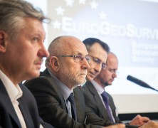
EuroGeoSurveys Membership –composed solely by the Geological Surveys of Europe – keeps growing steadily. At the EuroGeoSurveys General Meeting, held in Brussels on 24th March, EuroGeoSurveys welcomed 3 new members: the Latvian Environment, Geology and Meteorology Centre (LVGMC), the Geological Surveys of Serbia (GSS) and the Geological Survey of the Republic of Macedonia (GSRM). The vote, held in the morning during a closed-door session, brought the EGS Membership to 37 Geological Surveys, therefore almost fully covering the whole Europe. Ms. Anita Drondina, Head of Environment, Climate Change and Regional Policy Division at the Permanent Representation to the EU of Latvia, current President of the EU, and Ms. Inita Stikute, LVGMC Board Chair person, gave a presentation on the Latvian Environment, Geology and Meteorology Centre (LVGMC) and their interest in joining EGS as Full Member. The Geological Survey of Serbia (GSS) application as a Full Member was introduced by H.E. Ambassador Dusko Lopandic, Head of the Permanent Mission of the Republic of Serbia to the European Union, while Mr. Dragoman Rabrenovic, Director of GSS, presented the organization. H.E. Ambassador Andrej Lepavcov, Head of the Mission of the Republic of Macedonia to the European Union, introduced the application of the Geological Survey of Macedonia (GSRM). After the presentation of the Survey given by the Director Mr. Kostadin Jovanov, GSRM was officially introduced as Full Member of EGS. Moreover, in the afternoon session EuroGeoSurveys and the Geological Survey of Turkey (MTA) signed a Memorandum of Understanding. The agreement was signed by EGS President Mr. Koen Verbruggen and the MTA Director General Mr. Yusuf Ziya Cosar and is aimed to exchange scientific and technical experience and knowledge in areas such as marine geology, waste characterisation, climate change, preparation of geochemical atlas, etc. The enlargement of the EGS Membership,...
UNDERGROUND CHANNEL, the first geoscience video channel
posted by EuroGeoSurveys
Geocenter Danmark launches online video channel focusing on the geosciences. UNDERGROUND CHANNEL. Today sees the launch of the world’s first online video channel focusing on the geosciences. Backed by some of Denmark’s most prestigious research institutions, UNDERGROUND CHANNEL will use film to address the complicated challenges facing the planet – climate change, resource utilisation and sourcing clean drinking water – and to examine extreme phenomena such as earthquakes, volcanoes and tsunamis. “We live in an era of ever-increasing focus on the pursuit and distribution of the Earth’s resources. Competition for water, minerals and oil, the fear of climate change and concerns about the planet’s overall well-being have brought geology and the geosciences much closer to our everyday lives,” says Professor Kurt Kjær, a member of Geocenter Denmark’s management group and acting director of the Natural History Museum of Denmark. “But it’s sometimes difficult for school students and laypeople to find out about the state of the planet, its powerful natural forces and scarce resources, and about our collective future. That’s why we are launching UNDERGROUND CHANNEL – the world’s first online video channel focusing on the geosciences.” A window to the past – and the future “The Earth’s past seems infinite. It’s hard to imagine oceans emerging or continents moving. We’ll never be able to experience these processes in real time. But, by utilising the latest research, UNDERGROUND CHANNEL will create a window through which everyone can catch a glimpse both of our planet’s history and of what the future might hold,” says Anders Drud Jordan, project manager for UNDERGROUND CHANNEL. UNDERGROUND CHANNEL is backed by Geocenter Denmark – a formal collaboration between four of Denmark’s strongest geoscience institutions, all of which bring their expertise and latest research findings to the project. The institutions...
Global Soil Week 2015
posted by EuroGeoSurveys
The Global Soil Week 2015, a multi-stakeholder platform and process for the transformative change towards a more sustainable soil management and a more responsible land governance in our world, will take place from 19th to 23rd April 2015. This year’s Global Soil Week will highlight the importance of land and soil to achieve the Sustainable Development Goals in this, the UN designated International Year of Soils. On Thursday 23rd April Rainer Baritz, Chair of the EuroGeoSurveys Soil Resources and Superficial Deposit Task Force, will participate in the Open-Space Session “Discussion on European soil data base update in light of the revision of the Soil Atlas of Europe: examples from Finland and Central European countries” with the presentation “Parent material data for soil mapping and soil engineering in Europe”. The session is hosted by the European Commission Directorate General Joint Research Centre (DG JRC). The discussions aim to update information in the European Soil Database of mainly Central European countries. A specific example of the Finnish field-work approach to up updating information on agricultural soils will be presented as well. This update will contribute to the second edition of the Soil Atlas of Europe. This session is also open to institutions or researchers from other parts of Europe that are planning on updating their data in the European database. The work on the second Soil Atlas of Europe has started and this session will contribute towards updating maps for the new Atlas. The EGS contribution is part of the cooperation agreement with the DG JRC and the Global Soil Partnership (GSP) – supporting soil scientists with geoscientific knowledge and data and enhancing available information on soil for policy makers, researchers and society at large. For more information click here http://globalsoilweek.org/ ...
Copernicus Masters competition 2015
posted by EuroGeoSurveys
The Copernicus Masters competition 2015 is now open for submissions – with new challenges, industry leading partners and an immense prize pool. Since 2011, the Copernicus Masters competition (www.copernicus-masters.com) has awarded innovative products, services or applications that are based on Earth observation data. Its purpose is to drive the development of market-oriented applications for utilising data generated through Europe’s flagship satellite programme – Copernicus. In this year’s edition, prizes will be awarded in topic-specific challenges sponsored by a number of world-class partners, including: the European Space Agency (ESA), the German Aerospace Center (DLR), T-Systems International GmbH, Satellite Applications Catapult Ltd., Greece’s National Cadastre and Mapping Agency (NCMA), CloudEO AG, and European Space Imaging GmbH (EUSI). In addition, the new University Challenge specifically addresses students and research assistants around the world. The prize pool includes cash awards, satellite data access and quota as well as support-packages and is worth EUR 300,000. SMEs, start-ups, entrepreneurs, students and everyone with a brilliant idea is welcome to join and submit their entries from 15 April to 13 July 2015 at...
EU-wide survey on 3D modelling activities at Geological Survey Organisation
posted by EuroGeoSurveys
Online poll among European Geological Survey Organisations summarises activities in the field of 3D geological modelling and reveals the current state of progress An online survey was carried out across federal and state geological surveys of Europe between December 2014 and February 2015 to reveal the current state of progress in 3D geological modelling as well as the financial and human resources involved in geological modelling activities. Thirty-six institutions responded to the questionnaire leading to an almost complete coverage of European countries. Results show that 3D geological modelling at geological surveys really took off between 2001 and 2010 and by now, more than half of the participating countries have covered at least 20% of their area with regional scale geological models. In 2014, most survey organisations spent up to 50,000€ on 3D modelling. On average 60% of the total modelling budget are spent on modelling per se, while 10% go to software licence fees, 10% to programming and 20% to model dissemination. Virtually all Geological Survey Organisations in Europe perform 3D geological modelling as part of research projects related to groundwater, mineral resources or geothermal energy. As to the systematic 3D mapping of the subsurface, ten countries / states in Europe stipulate 3D geological models by legal mandate. Only in four of those, there also are legal requirements to follow national standards for 3D data models. While most geological surveys carry out geological modelling by employing their own staff, some have outsourced the task to research institutes and/or universities. Although some modelling activities were undertaken already in the eighties and nineties, the majority of geological survey organisations started 3D geological modelling between 2001 and 2010. Up until now they spent up to ten person-years on modelling. By the end of 2014,...
GEOETHICS AT THE EGU 2015
posted by EuroGeoSurveys
During the EuroGeoSurveys 38th General Meeting, EuroGeoSurveys and the International Association for Promoting Geoethics (IAPG) signed a Cooperation Agreement with the aim of cooperating in a range of themes in the field of geoethics and promoting initiatives and events discussing the ethical, social and cultural implications of geosciences. Starting from the definition of ethics by Aristotle, the IAPG (International Association for Promoting Geoethics) has defined geoethics as “the research and reflection on the values which underpin appropriate behaviours and practices, wherever human activities interact with the geosphere”. Geoethics deals with the ethical, social and cultural implications of Earth Sciences education, research and practice, and with the social role and responsibility of geoscientists in conducting their activities. For the third year the IAPG has organized a session on geoethics at the European Geosciences Union (EGU) – General Assembly, titled “Geoethics for society: General aspects and case studies in geosciences” (session EOS8). The raising interest in geoethics is testified by the growing number of abstracts submitted since 2013. The session will be held on 15 April 2015, from 13:30 to 17:00 in the Room R12 (12 orals) and from 17:30 in the Red Posters Area (30 posters) at the Austria Centre Vienna, and will be convened by Silvia Peppoloni (Italy), Eduardo Marone (Brazil) and Nic Bilham (United Kingdom). The first part of the session, titled ”putting geoethics at the heart of geosciences”, is an overview on general issues of ethics in relation with geosciences, such as geoeducation, geoscience professionalism, scientific ethics, geoethics applied to georesources. The second part is focused on “Geoethics and geohazards”, with particular attention to prepardness strategies, mitigation policies, probabilistic-deterministic views, social impacts, risk communication and disaster management. Information on the session EOS8 are available in the IAPG website: http://www.iapg.geoethics.org/evidence/egu2015. International Association for...
FUCINO 2015 | EGS – EPOS Workshop
posted by EuroGeoSurveys
EuroGeoSurveys will participate to FUCINO 2015 – 6th INIQUA International Workshop. The event will celebrate the centenary of the 1915 M7 Fucino earthquake, one of the most devastating earthquakes occurred in the Apennines. EuroGeoSurveys (EGS) and the European Plate Observing System (EPOS), an integrated solid EarthSciences research infrastructure aimed at promoting innovative approaches, organize a joint Workshop on Tuesday 21 April, 17.00 – 18.30. The Workshop aims at showing to the Fucino 2015 participants the activities carried out in the frame of earth sciences research infrastructure initiatives. EPOS and EuroGeoSurveys representatives will sign a Memorandum of Understanding for future joint collaboration. In particular, EuroGeoSurveys decided to establish a European Geological Data Infrastructure (EGDI), a cornerstone of EGS strategy that supports the development of a European Geological Service. The EGDI will support policy makers, industry and academia in addressing Europe’s societal challenges by making interoperable geological data and information available in a uniform way. One of the most obvious user groups for the geological information is EPOS, which will be implemented in the coming years and aims at creating a pan‐European infrastructure for solid Earth science to support a safe and sustainable society. Therefore the MoU purpose is to ensure a long-term cooperation between the two initiatives regarding integration and exchange of data, information, systems and knowledge. In that way the value of data and infrastructures are optimized to serve the interests of all potential users of the two systems to the widest possible extent. The EPOS will invite the participants of the forthcoming EGU General Assembly to the EPOS Townhall Meeting (TM8) on Tuesday April 14 2015 from 19:00 – 20:00 in Room B8. The meeting will discuss about the relevance of integrating research infrastructures and will be a forum for a broad debate...
EuroGeoSurveys Director’s Workshop “Geological Infrastructure priorities in Africa and beyond”
posted by EuroGeoSurveys
The EuroGeoSurveys Director’s Workshop took place on 25th March 2015 in Brussels. The yearly meeting of the Directors of the European Geological Surveys and Geological Surveys from all around the world was focused on the theme “Geological Infrastructure priorities in Africa and beyond”, discussing the geological infrastructure needs in Africa and in other areas of the world. The Workshop topic matched the High level Conference ‘EU-AU Joint Session on Infrastructures for the Minerals Sector’ of the previous week, focusing on the infrastructure needs of the minerals sector in Africa (including transport, ICT, water and energy as well as all other types of infrastructure). EuroGeoSurveys welcomed high level guests from Africa, North America, Europe, Asia, etc. together with representatives of EU Institutions and stakeholders, resulting in a very high attendance of about 90 participants. Ms Françoise Moreau, Head of the Africa-EU Partnership, Peace Facility Unit at the European Commission’s DG for Internal Cooperation and Development, explained that in the context of the Joint EU Africa Strategy, of which Roadmap 2014-2017 was adopted last year, raw materials and mineral resources have been identified among the priorities for future cooperation and political dialogue between Europe and Africa. In this regard, the Pan-African Programme established in 2014, the first covering Africa as a whole, supports projects with added-value in areas of shared interest for the EU and Africa. This is why the EC supports the reinforcement of the cooperation between African and European geological surveys with a view to provide to interested African governments better information on their still unexploited mining resources. The economic boom of several African countries should be maximised and that growth should be translated in poverty reduction. This means that the exploitation of the benefits of raw materials should benefit local population. The DG...
European Geoscience Union Assembly 2015 | Vienna 12-17 April 2015
posted by EuroGeoSurveys
The General Assembly of the EGU will be held in Vienna, Austria, from 12th to 17th April 2015. The 2015 theme, A voyage through scales, is an invitation to contemplate the earth’s extraordinary variability extending from milliseconds to its age, from microns to the size of the planet. EuroGeoSurveys will be present at EGU Assembly in three different sessions. EGU-AOGS (Asia Oceania Geosciences Society) Great Debate on Impact on global geoscience of accelerating Asian research – Mr J. Ludden | Mon, 13 April 15:30–17:00 | Room Y1. This session will address the impact on global geosciences of the rapid growth of scientific and technological research in Asian countries. Some of the topics covered will include the enormous increase in the numbers of papers submitted to scientific journals, participation in international science programs, opportunities and implications of collaboration and mobility of researchers between Asian countries and the West, etc. The Director of the British Geological Survey, Mr John Ludden, will represent EuroGeoSurveys. Mr Ludden has been EuroGeoSurveys’ President in the period 2009-2010. Geoscience Information for Teachers (GIFT) Workshops –Mr C. Burlet | Wed, 15 April 8:30 -13:00 | Room G10. The main objective of these workshops is to communicate first-hand scientific information to teachers in primary and secondary schools, significantly shortening the time between discovery and textbook. The GIFT workshop provides the teachers with materials that can be directly incorporated into their classroom, to explain related scientific principles or topics. Mr Christian Burlet, from the Geological Survey of Belgium, will present the EU co- funded Minerals4EU Project, and the EuroGeoSurveys book “Minerals in your life”. Communication and Education in Geoscience: Practice, Research and Reflection – Outreach and Public Engagement Case Studies – Ms C. Delfini | Thursday 16 Apr 13:30-13:45 | Room R12....

