The ambition of the European Union is to deliver a secure, competitive and sustainable energy system, while reducing GHG emissions by at least 40% by 2030 on 1990 levels. The European Strategic Energy Plan (SET plan) aims to accelerate the development and deployment of low carbon technologies and recognizes CCS as an important mitigation technology. The wide-scale deployment and transfer of carbon dioxide capture, transport and storage (CCS) is recognized by the UNFCCC as an environmentally sound technology; as well as by the International Energy Agency (IEA) as a major opportunity for cost–effectively reducing global emissions. For large-scale emissions to be managed adequately within the time frames required, CCS must be allowed to play its crucial role in the decarbonisation of the energy and industrial sectors. CO2GeoNet – The European Network of Excellence on the Geological Storage of CO2, joins together 26 partners from 19 European countries, ranging from national geological surveys, through to research institutes and universities, all with a high international profile and critical mass in CO2 geological storage research. CO2GeoNet is contributing, in collaboration with other international organisations, to side-events and booths at COP21. EuroGeoSurveys is co-organizer together with the European Energy Research Alliance and the Global CCS Institute of the side event “The role of CCS in mitigating climate change” that will be held at the EU Pavillon, room Luxembourg at 10:15-11:00 o’clock. Key players from research organisations, major CCS knowledge networks and initiatives as well as key policy makers in Europe will discuss with the audience the status and way forward for CCS as part of Europe’s low carbon future. The role of CCS in mitigating climate change 10:15-11:00 (EU Pavillon, room...
The role of CCS (Carbon dioxide Capture and Storage) in mitigating climate change
posted by EuroGeoSurveys
Interview with Mr Kostadin Jovanov, Director of the Geological Survey of Macedonia
posted by EuroGeoSurveys
Could you describe the main activities of the Geological Survey of Macedonia and its public role in FYROM? The Geological Survey of the Republic of Macedonia is an expert, independent, administrative organization, established for doing basic geological research of public interest in the Republic of Macedonia. Most of our activities are focused mainly on the development of geological research related in particular to the preparation of basic geological, hydrogeological, engineering-geology, geochemical and seismotectonic maps and other geological maps, making them available to the public . All the work that we carry out is done on the basis of – and following the – priorities of the Republic of Macedonia We are very active also in the determination of the legal regularity of concentration and distribution of natural mineral resources in the Earth’s crust. In particular, we take part in the preparation of the Strategy for geological research, use and sustainable exploitation of minerals. Moreover our geological knowledge is essential for physical planning, construction, water supply, agriculture, forestry, urbanization and construction of infrastructure facilities, helping policy makers to make the best choices for the development of our country. We really believe in the exchange of geological information and experiences with international geological institutions in order to prepare and develop common research projects and to unify synergies for the implementation of the International Geological Information System, a single Geological Information System, able to provide information and data to the users of geological research results. We are also developing a Programme for basic geological research of the area of the Republic of Macedonia for the Government of the Republic of Macedonia The basic geological research is developed through an Annual Programme, which is adopted by the Government of the Republic of Macedonia upon advice of the Geological...
Interview with Ms Daiga Pipira, Head of Geology Division at the Latvian Environment, Geology and Meteorology Centre
posted by EuroGeoSurveys
What is the basic role of the Latvian Environment, Geology and Meteorology Centre in Latvia? What are the main research areas? State Ltd. “Latvian Environment, Geology and Meteorology Center” (LEGMC) is the largest institution in Latvia engaged in the collection and processing of geological information. However, the main areas of research at LEGMC also include meteorological and hydrological observations and forecasting, air quality monitoring, chemicals and hazardous waste management. For this work LEGMC employs 260 lead qualification specialists. LEGMC Information Analysis Department has several branches: Division of Geology, Division of Inland Waters (hydrology and hydrogeology), Chemicals and Hazardous Waste, and Air and Climate Division. The main activities in the field of geology can be divided into three basic groups: 1) accomplishment of State delegated assignments, 2) commercial side which includes preparation of geological information upon request of other institutions and private sector and 3) participating into national and international projects of different scale. The main tasks of LEGMC in the area of geology are following: Approval of mineral reserves according to the legislation; Preparation of the annual balance of mineral reserves, collection and storage of geological information; Preparation and provision of geological and geospatial information for the needs of the state, society and land users; Investigations of quality of subsoil, geological and geoecological investigations of different hazards to the environment and population; Preparation and evaluation of information regarding mineral deposits occurring in subsoil; Seismic monitoring. Collection and storage of geological information is the main task of LEGMC according to Law on Subsoil. Almost 30,000 thousand reports as well as maps and field books are stored in the State Geological Fund: results of geological mapping, results of geological prospecting, information on mineral deposits and mineral resources, results of geology investigations and engineering, geoecological investigations. This...
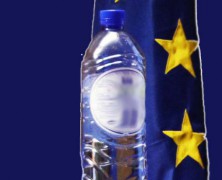
EGG: European Groundwater Geochemistry, a model geochemical study of bottled mineral water in Europe
posted by EuroGeoSurveys
A paper on European Groundwater Geochemistry has just been published in the “European Geologist”, the Journal of the European Federation of Geologists, special issue “Towards 2020: groundwater research in Europe”. Demetriades, A., Cullen, K., Reimann, C. & Birke, M., 2015. EGG: European Groundwater Geochemistry. Special Issue: Towards 2020: groundwater research in Europe, European Geologist, 40, 20-28. To download the paper, click here The full version of the Special Issue can be downloaded at http://eurogeologists.eu/wp-content/uploads/2015/11/EGJ40_final_LR.pdf...
GEO-XII Plenary & Ministerial Summit Week | The AfriGEOSS Side Event
posted by EuroGeoSurveys
The Group on Earth Observation XII Plenary and the 2015 Mexico City Ministerial Summit, as well as all associated meetings and events, will be hosted by the Government of Mexico and will take place in Mexico City from 9 to 13 November 2015. The AfriGEOSS Side Event will take place on the 10th of November 2015, (14.00 – 18.00 PM). The AfriGEOSS initiative, developed within the GEO framework, aims to enhance Africa’s capacity for producing, managing and using Earth observations data and information and to strengthen the link between GEO activities and existing capabilities and initiatives in Africa. The Side Event will review progress made towards the implementation of AfriGEOSS since its launch, including progress on developing the concept for data access and dissemination in Africa. The Workshop aims at creating synergies and coordination with a number of activities contributing to AfriGEOSS in order to strengthen efforts. In particular the side event will use the recently awarded PanAfGeo project to explore harmonization with existing efforts, especially in the area of mapping and training. PanAfGeo will enhance the capacity and role of African National Geological Surveys (i.e. regional mapping and exploration, mineral resources assessments, trainings, etc.), and therefore represents an opportunity for many African GEOSS stakeholders involved in the geosciences to have their concerns addressed. In this framework the session has the scope to initiate discussions on the involvement and role of non-Geological Survey stakeholders and the benefits to GEOSS. GEO has been formally listed as a key PanAfGeo stakeholder, and its opinion will be taken into consideration during the project development. Moreover PanAfGeo will partially continue the AEGOS (Africa-Europe Geoscientific Observation Network) Project, which was contributing to AfriGEOSS. If you are interested in attending the workshop, it is necessary to register at the following...