Every two years, a new edition of the European Minerals Day (EMD) event gives the opportunity to discover the world of minerals and the importance of the mineral sector in our daily life activities. In this context, EuroGeoSurveys is joining its efforts again with a consortium of 11 European partners for supporting the event and reaching its main aims. Read the full press release in order to know...
EUSEW 2019: GeoPLASMA-CE and EGS supporting Europe’s Energy Future
posted by EuroGeoSurveys
In occasion of the EU Sustainable Energy Week event (EUSEW 2019), EGS and GeoPLASMA-CE renovate their joint effort highlighting the need for the integration of European geoscientific data and knowledge in the EU policy development and implementation process. Click here to view/download the...
First pan-European shoreline-migration map since 2004
posted by EuroGeoSurveys
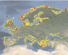
The shoreline is a highly dynamic land-sea interface that provides important services such as ecology, flood protection and recreation. It is constantly modified by wind, waves and tides, and impacted by human activity.Hence, the decadal change of shorelines reflect natural processes as well as human influence, whether positive or negative. Climatic-driven changes such as sea level rise, higher waves and changes in wind direction put increasing pressure on many of Europe’s shorelines. Knowing how, and at what rate, our coasts are changing is the first step to successfully managing them. The new EMODnet Geology shoreline-migration map, released today, allows users to visualise pan-European coastal behaviour for 2007-2017 at different spatial scales. A built-in search and zoom functionality allows online users to distinguish areas of landward migration (erosion or submergence), stability, and seaward migration (accretion or emergence). The underlying, downloadable satellite-based dataset offers additional information on annual values and uncertainty. Click here to view/download the...
EGS Strategy and need for European geoscientific data and knowledge in EU policy developments
posted by EuroGeoSurveys
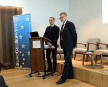
EuroGeoSurveys President, Dr. Zdenek Venera, opened the EGS Directors Workshop on the need for European geoscientific data and knowledge in EU policy developments and the EGS strategy explaining how the National Geological Surveys, members of EuroGeoSurveys (EGS), are public sector institutions carrying out operations and research in the field of geosciences, with a long tradition in collecting data, preparing information and conducting research focused on their national subsurface. Besides their national mandates, EGS members play an important role in EU policy developments by providing the European institutions with geoscientific data and knowledge for the benefit of society. Click here to view/ download the...
EGS Participation to PDAC
posted by EuroGeoSurveys
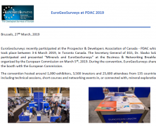
EuroGeoSurveys recently participated at the Prospector & Developers Association of Canada – PDAC which took place between 3-6 March 2019, in Toronto Canada. The Secretary General of EGS, Dr. Slavko Solar participated and presented “Minerals and EuroGeoSurveys” at the Business & Networking Breakfast organized by the European Commission on March 5th, 2019. During the convention, EuroGeoSurveys shared the booth with the European Commission. The convention hosted around 1,000 exhibitors, 3,500 investors and 25,600 attendees from 135 countries, including technical sessions, short courses and networking events in, or connected with, mineral exploration. Click here to download the...
Visibility for the European Landslide Density Map
posted by EuroGeoSurveys
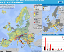
EuroGeoSurveys – Earth Observation and Geohazards Expert Group and European Geological Data Infrastructure (EGDI) are glad to announce that on the 18th February 2019 the European Landslide density map has been published at the European Commission ERCC PORTAL, Emergency Response Coordination Centre (ERCC), European Civil Protection and Humanitarian Aid Operations. Click here to download the...
Update about the PanAfGeo project- Mining Indaba 2019
posted by EuroGeoSurveys
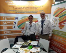
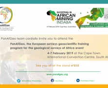
The PanAfGeo project is now taking part to the Mining Indaba event 2019! The event, happening this week from the 4th to 7th February will take place in Cape Town, South Africa, where the most influencing personalities working in the mining sector are expected to participate. If you are interested in the African geology and want to know more about the sustainable use of African mineral resources and infrastructure, do not hesitate to visit the PanAfGeo booth number 515 at the Mining Indaba event! Moreover, we seize the opportunity to present you our new post card available in both English and...
Update about the PanAfGeo project – Presence at the Mining Indaba conference
posted by EuroGeoSurveys
We would like to update you about the progress of the PanAfGeo project and the substantial visibility it is providing to EuroGeoSurveys and its members. Click here to download the...
GEO WEEK 2018: Supporting a resilient and sustainable world
posted by EuroGeoSurveys
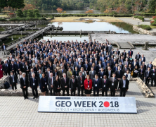
Over 500 people came together for GEO Week 2018 from 29 October – 2 November 2018 in Kyoto, Japan. The week’s events focused on GEO’s three priority engagement areas: the Sendai Framework for Disaster Risk Reduction, the Paris Climate Agreement, and the United Nations 2030 Agenda for Sustainable Development. Gerardo Herrera and Veronika Kopackova represented EuroGeoSurveys and the Earth Observation Geohazards Expert Group. Click here to download the summary of the...
Workshop on UNFC Sustainable Resources Management in Europe at the EU Raw Materials Week
posted by EuroGeoSurveys
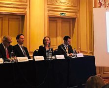
The workshop on “UN Framework Classification for Sustainable Resources Management in Europe”, was organised in the frame of the EU Raw Materials Week on 16 November 2018 in Brussels, by the United Nations Economic Commission for Europe (UNECE), the European Commission, the European Federation of Geologists (EFG) and EuroGeoSurveys (EGS). Click here to download the press...

