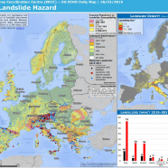
Visibility for the European Landslide Density Map
EuroGeoSurveys – Earth Observation and Geohazards Expert Group and European Geological Data Infrastructure (EGDI) are glad to announce that on the 18th February 2019 the European Landslide density map has been published at the European Commission ERCC PORTAL, Emergency Response Coordination Centre (ERCC), European Civil Protection and Humanitarian Aid Operations.
Click here to download the file.

 EGS News RSS