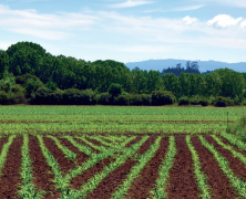
A review of the GEMAS Atlas by Steve McGrath, one of the top soil scientists in Europe, on the August issue of Elements Magazine “Social and Economic Impacts of Geochemistry”. CHEMISTRY OF EUROPE’S AGRICULTURAL SOILS This two volume set (Parts A and B) arose from a project called the Geochemical Mapping of Agricultural and Grazing Land Soil in Europe (GEMAS). In this project, 2108 soil samples from ploughed land (0–20 cm depth)and 2023 samples of grazing land (0–10 cm depth) were collected in 2008/9 over an area of 5.6 million km2, at a density of about 1 per 2,500 km2. This was accomplished by a tremendous consortium of European national geological surveys, geologic institutions, academics, and industry. These groups used the same sampling protocols, with chemical analyses of all samples being carried out at specific labs. This ensured maximum comparability of the results from 33 countries across Europe. Oh, except Albania, Belarus, Malta, Moldova and Romania, which appear as blank spaces on the maps. Others outside Europe were also involved, from Australia, Canada and New Zealand. It was a truly international effort. I hear you ask, “What chemical analyses did they make on these samples?” Well, quite a lot: too many to list here, in fact. In summary: total elemental analysis for 41 elements, aqua regia extractions for 53 elements, pH, effective cation exchange capacity (eCEC), total carbon, total organic carbon, lead isotopes, magnetic susceptibility, partial extractions for 56 elements, percent clay, and solid–liquid partitioning of elements. A real data-fest! Apparently, the project is not finished: for example, Sr isotope data are now being collected. Keep reading… Download the...
8th EureGeo -European Congress on Regional Geoscientific Cartography and Information Systems
posted by EuroGeoSurveys
18th June 2015 It has just ended the 8th European Congress on Regional Geoscientific Cartography and Information Systems (EureGeo), held in Barcelona with the participation of over 150 scientists from all around Europe. The Congress was opened on 15th June by the Directors of the European Regions of Bavaria, Catalonia and Emilia-Romagna, the President of EuroGeoSurveys (EGS) and the Head of Soil Contamination activities of the European Commission DG Joint Research Centre (DG JRC). The importance to provide fast, digital and understandable data to general public, has been the main message of the European Regions, while Mr Koen Verbruggen, President of EuroGeoSurveys, highlighted the necessity to strengthen the collaboration among all the Regions and to work together to solve common problems. Since many years, EGS is working more and more to increase the involvement of the European Regions in the work carried out by National Geological Surveys at EU and global level under the EuroGeoSurveys umbrella. The congress, focused on two main themes Geological 3D Modelling and Soils, has been an opportunity for exchanging ideas and sharing experiences among the participants. As explained by Ana Payà-Pérez, Scientific Projects Officer at the Joint Research Centre, the Regions have a key role in the implementation of the Soil Thematic Strategy and the Road Map to a Resource Efficient Europe; and the congress is an opportunity to present new ways to monitor the state of the soils, as well as new methods and proposals on how to restore degraded soils. The European Commission is making available various forms of financial support through the LIFE programme, Regional Developments Funds and Horizon 2020 to foster collaborations and joint research between institutions in Europe. ...
Global Soil Week 2015
posted by EuroGeoSurveys
The Global Soil Week 2015, a multi-stakeholder platform and process for the transformative change towards a more sustainable soil management and a more responsible land governance in our world, will take place from 19th to 23rd April 2015. This year’s Global Soil Week will highlight the importance of land and soil to achieve the Sustainable Development Goals in this, the UN designated International Year of Soils. On Thursday 23rd April Rainer Baritz, Chair of the EuroGeoSurveys Soil Resources and Superficial Deposit Task Force, will participate in the Open-Space Session “Discussion on European soil data base update in light of the revision of the Soil Atlas of Europe: examples from Finland and Central European countries” with the presentation “Parent material data for soil mapping and soil engineering in Europe”. The session is hosted by the European Commission Directorate General Joint Research Centre (DG JRC). The discussions aim to update information in the European Soil Database of mainly Central European countries. A specific example of the Finnish field-work approach to up updating information on agricultural soils will be presented as well. This update will contribute to the second edition of the Soil Atlas of Europe. This session is also open to institutions or researchers from other parts of Europe that are planning on updating their data in the European database. The work on the second Soil Atlas of Europe has started and this session will contribute towards updating maps for the new Atlas. The EGS contribution is part of the cooperation agreement with the DG JRC and the Global Soil Partnership (GSP) – supporting soil scientists with geoscientific knowledge and data and enhancing available information on soil for policy makers, researchers and society at large. For more information click here http://globalsoilweek.org/ ...
 EGS News RSS