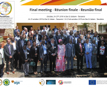
On 24 and 25 October 2019, about 70 PanAfGeo partners from around 50 European and African countries gathered in Dar es Salaam, Tanzania, for the Phase 1 closing meeting. The Ministers responsible for minerals in Tanzania and Kenya were the guests of honour. Attendees included some of the project’s main contributors: OAGS Executive Committee members, stakeholders and representatives of Geological Surveys in Africa and Europe and the European Commission. An overview of all the PanAfGeo Project activities performed under each work package was presented and was followed by a feedback session. A complete review of the three years of training was presented by each WP leader. The complete list of the PanAfGeo work packages are available here: www.panafgeo.eurogeosurveys.org/about The PanAfGeo Project: an overview (2016-2019) Results and impacts: PanAfGeo increased the technical competence of 1,074 trainees from 49 African countries (all except Burundi, Libya, Mauritius, Seychelles and Somalia). No other EU programme so far has ever had such a cross-continental geographical coverage, overcoming language (trainings in three languages: English, French, Portuguese), cultural and political barriers. The European Commission’s intention of increasing attention for more effective cooperation with Africa has therefore been fully met by PanAfGeo Phase 1, through its geoscience training programmes for officers of African Geological Surveys. The programme has clearly strengthened the partnership between EU and African countries in several areas, bringing substantial benefits to the societies in Africa and, indirectly, in Europe, through the establishment of stable institutional relations based on mutual trust and respect. The consideration of many African Ministers being present at various PanAfGeo events proves the impact generated at the highest decision making and political levels. The future – PanAfGeo Phase 2: Nevertheless, there is always room for improvement and the framework of possible work packages for PanAfGeo-2 were...
First EGS Urban Geology Expert Group Meeting
posted by EuroGeoSurveys
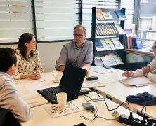
EuroGeoSurveys (EGS) – Stephanie Bricker (BGS – Chair) welcomed everyone to the first UGEG meeting at the EGS Secretariat in Brussels, Belgium. Wider interests and experience of the UGEG are also presented in the biographies that had been prepared by the participants. The meeting had around 24 members representing approximately 16 European Surveys. Click here to...
EGS Strategy and need for European geoscientific data and knowledge in EU policy developments
posted by EuroGeoSurveys
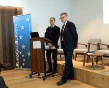
EuroGeoSurveys President, Dr. Zdenek Venera, opened the EGS Directors Workshop on the need for European geoscientific data and knowledge in EU policy developments and the EGS strategy explaining how the National Geological Surveys, members of EuroGeoSurveys (EGS), are public sector institutions carrying out operations and research in the field of geosciences, with a long tradition in collecting data, preparing information and conducting research focused on their national subsurface. Besides their national mandates, EGS members play an important role in EU policy developments by providing the European institutions with geoscientific data and knowledge for the benefit of society. Click here to view/ download the...
Visibility for the European Landslide Density Map
posted by EuroGeoSurveys
EuroGeoSurveys – Earth Observation and Geohazards Expert Group and European Geological Data Infrastructure (EGDI) are glad to announce that on the 18th February 2019 the European Landslide density map has been published at the European Commission ERCC PORTAL, Emergency Response Coordination Centre (ERCC), European Civil Protection and Humanitarian Aid Operations. Click here to download the...
Update about the PanAfGeo project – Presence at the Mining Indaba conference
posted by EuroGeoSurveys
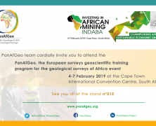
We would like to update you about the progress of the PanAfGeo project and the substantial visibility it is providing to EuroGeoSurveys and its members. Click here to download the...


